I have devoted my career to gain a deep knowledge in GIScience. Currently, I am a GIS engineer at Medici Land Governance, a subsidiary of Overstock.com. The company creates systems to collect and easily secure property ownership information using blockchain technology. I support MLG’s growing number of projects around the globe that provide user-friendly, low-cost land administration systems by providing GIS expertise to the team. In 2018, I recieved my PhD from the Geography Department at the University of Colorado Boulder.My PhD studies in the Geography Department and my background obtained in Civil Surveying helped me in developing and implementing concepts and applications that combine modern science with classical engineering concepts in the GIS environment. I am interested in developing spatial data structures and geometric algorithms, the analyzing and mining of complicated spatial data, and linking geospatial mathematical concepts to real-world issues. I am specialized in terrain modelling, geocomputation, and GIS/Python programming. My doctoral focused on incorporating terrain slope and curvature into GIS modeling computations, monitoring the reduction in error that occurs across multiple scales.
PhD in Geography/GIScience, Dec 2018 (expected)
University of Colorado Boulder
MSc in Geospatial Information Science, 2012
University of Tehran
BSc in Civil Surveying (Geomatics), 2010
University of Isfahan
Slope-Adjusted 
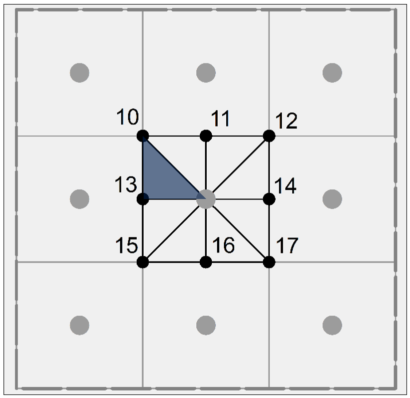
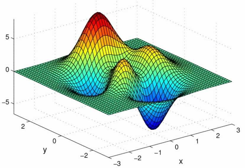
Surface Area Computations in Digital Terrain
Course projects in my bachelor (Civil Surveying) –(2006-2010)
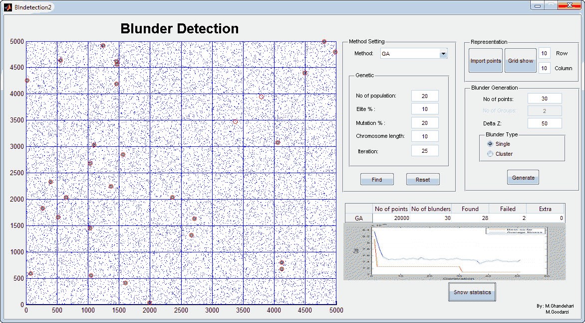
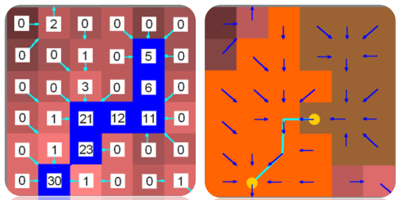
Gross error detection in Digital Elevation models Using Metahuristic Algorithms
Coded world equal area map projections using python and ArcPy
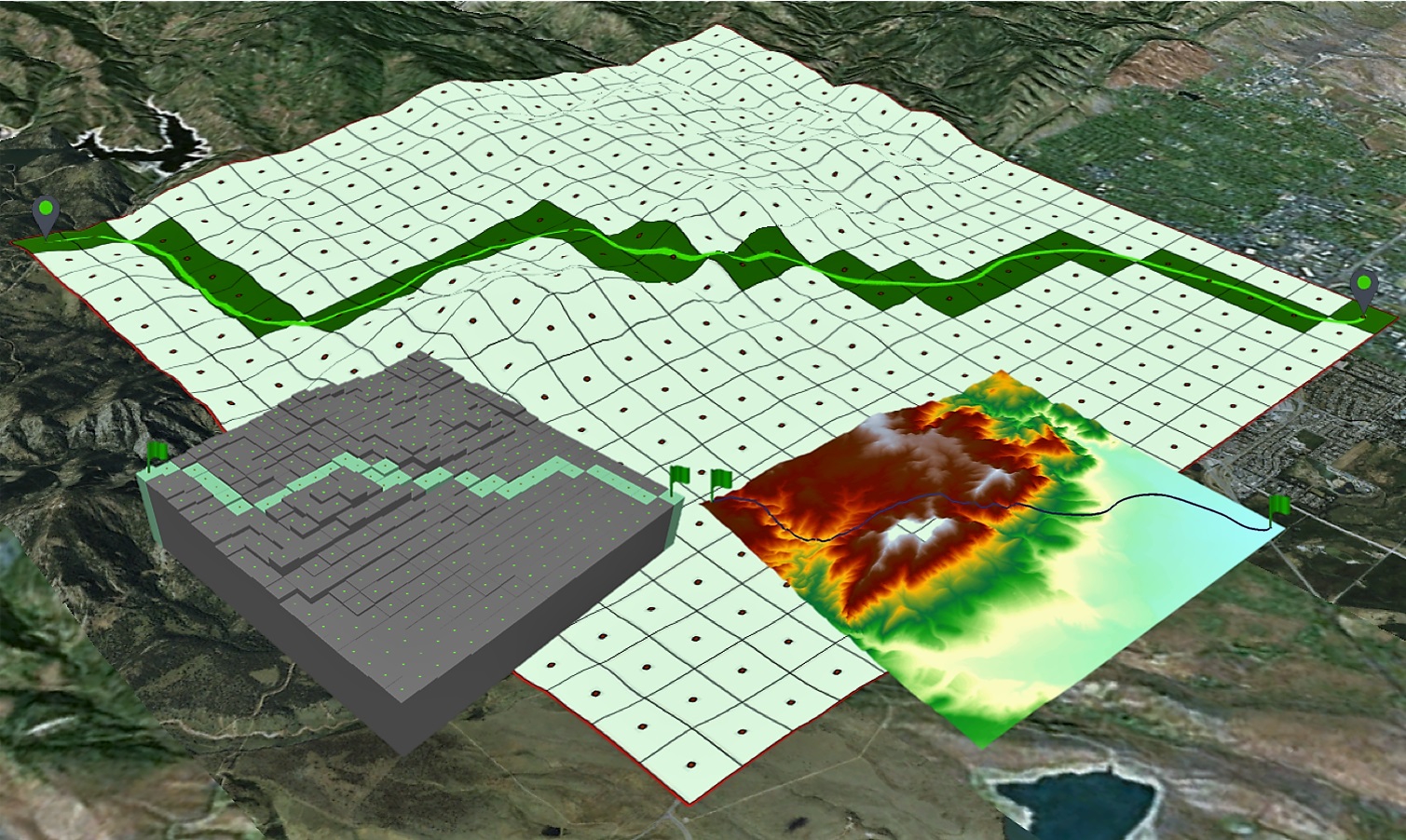
This project presents one possible strategy for the incorporation of surface area into a flow accumulation matrix
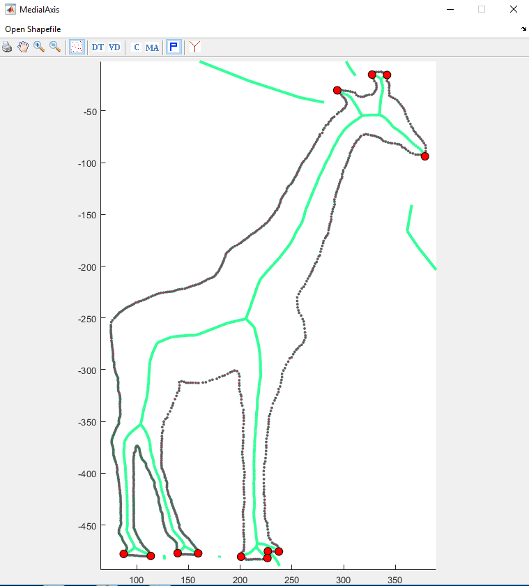
A Voronoi-base Algorithm for Medial Axis Extraction (Case Study: Watershed Delineation from River Networks)
Metaheuristic Optimization algorithms: the Genetic, Bee colony, Ant colony, Particle Swarm Optimization, Cat Swarm Optimization, Tabu search, and Hill Climbing.
Automating Flow Accumulation Thresholds for Extracting Stream Networks from Digital Elevation Models
Cross-Scale Analysis of Sub-pixel Variations in Digital Elevation Models
Cross-scale Analysis of Surface Adjusted Distance in Digital Terrian
2014-now: Teaching Assistant, Department of Geography, University of Colorado Boulder (Faculty Course Questionnaire (FCQ))
GIS Programming - GEOG4303/5303 (Spring 2018); Instructor: Prof. Stefan Leyk Syllabus
Cartography, Information Design and Representation - GEOG3053 (2015, 2016, 2017, and Fall 2018), Instructors: Prof. Barbara Buttenfield, Dr. David Parr, Dr. Sara Kelly, Dr. Eric Lovell Syllabus
Introduction to GIS - GEOG4103/5103 (Fall 2014, Spring 2015), Instructors: Prof. Barbara Buttenfield, Dr. Chris Anderson Syllabus
Aug 2013 - May 2014: Part-time Instructor, Geomatics Department, Daneshpajoohan University, Isfahan, Iran
2011-Feb: Invited lecturer, University of Kerman, GIS and RS department.
Fall 2011: Teaching Assistant, University of Tehran, School of Surveying.
Fall 2008: Teaching Assistant, Department of Surveying and Geomatics Engineering, University of Isfahan, Isfahan, Iran - Least Square and Error Adjustment, Dr. Jamal Asgari